ALTA Survey Guide for Real Estate Closings

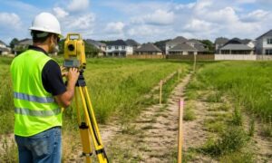
Land surveyor using a theodolite at a commercial property construction site during an ALTA survey

When you’re buying or selling commercial property in Texas, there’s one important step that can’t be skipped: getting an ALTA Survey. This special type of land survey plays a key role in real estate deals, especially when lenders and title companies are involved. Without it, the closing process can face major delays—or even fall through.

Why is an ALTA Survey Required in Texas Real Estate Deals?

In Texas, an ALTA Survey is often required for commercial property sales. This is because lenders and title insurance companies need to be sure there are no surprises about the land’s boundaries or legal issues.

Here’s why it’s important:

  • It helps confirm the legal description of the land
  • It shows any risks that could affect the property’s value or use
  • It helps lenders and buyers avoid future legal problems
  • It makes sure the property meets local zoning and building rules

Without an ALTA Survey, buyers and lenders could be exposed to serious risks after the deal closes.

How is an ALTA Survey Different from a Boundary Survey?

A boundary survey is a basic survey that shows the property lines. It’s often used for smaller deals or residential properties.

An ALTA Survey, on the other hand, is much more detailed. It includes:

  • Information from the title report
  • Easements and restrictions
  • Buildings, fences, parking lots, and other improvements
  • Optional items chosen by the buyer or lender (called “Table A items“)

Think of a boundary survey as a simple map, while an ALTA survey is a complete report made for real estate professionals.

Texas-Specific Requirements for ALTA Surveys

In Texas, some details can make ALTA Surveys a bit different than in other states.

For example:

  • Many properties in Texas have easements for oil and gas lines, which must be shown on the survey
  • Access rights are a big issue in rural areas, so surveyors need to check road connections
  • Some buyers ask for extra items like flood zone info, zoning details, or utility locations (Table A items)

Texas also requires that ALTA Surveys be done by a licensed Registered Professional Land Surveyor (RPLS).

Timeline and Costs for an ALTA Survey in Texas

The time and cost of an ALTA Survey in Texas can vary depending on the property.

Typical timeline:

  • 2 to 4 weeks for most properties
  • More time may be needed if the land is large or complex

Typical cost:

  • $2,000 to $5,000+
  • Larger or more detailed surveys can cost more
  • Adding optional Table A items also increases the price

To help speed up the process, it’s a good idea to provide the title report and legal documents early.

Who Orders and Pays for the ALTA Survey?

In most cases, the buyer or lender orders the ALTA Survey during the due diligence period.

The cost is usually paid by:

  • The buyer, especially in commercial deals
  • Sometimes the seller, if it’s part of the contract agreement

It’s also common for the seller to provide an older survey, but lenders often require a new or updated one.

Final Thoughts

An ALTA Survey is a key part of any commercial property deal in Texas. It protects everyone involved—from buyers and lenders to title companies—by clearly showing what’s on the land and what legal issues might exist. Knowing how it works can help make the real estate closing process smoother, faster, and more secure.

author avatar
Surveyor

More Posts

Homeowner and land surveyor reviewing property boundary markers and planned fence placement in a residential backyard before installation
boundary surveying
Surveyor

Do You Need a Property Survey Before Installing a Fence?

Building a fence sounds simple. Pick a style, hire a contractor, and start installation. But before any posts go into the ground, a property survey for fence installation can help homeowners avoid problems that often appear after work begins. In Bryan, Texas, where neighborhoods continue growing and property improvements are

Read More »
Aerial view of an office building with a blue and green drainage map overlay showing storm drains and elevation labels in the parking lot area.
land surveying
Surveyor

How LiDAR Mapping Helps Document Drainage Conditions 

Houston property owners are starting to run into a new kind of problem. It’s not always about building something new. Instead, it often comes down to proving what already exists on the property. Recent stormwater discussions around the Houston area show how things are changing. Fees and reviews now depend

Read More »
Aerial view of cars moving through a busy intersection showing traffic flow and turning patterns at a signalized crossing
civil engineering
Surveyor

Why Early Transportation Engineering Prevents Project Delays 

Fort Worth keeps growing. New stores, new offices, new neighborhoods show up every year. That sounds like progress, and it is. But behind every new project, there’s one thing that often gets ignored at the start: how people will actually get in and out. That’s where transportation engineering comes in.

Read More »
Licensed surveyor conducting boundary measurements on open land using GPS surveying equipment during a pre-purchase inspection
land surveyor
Surveyor

What a Licensed Surveyor Finds Before You Buy Land

Buying land in McKinney looks simple at first. You see a listing, you check the price, and the lot seems ready for a new home or project. However, things rarely match what people expect. A licensed surveyor often finds details that change how buyers think about the property before any

Read More »
Construction site in a suburban street showing an open utility trench with exposed pipes, workers, and machinery, illustrating engineering services during early road work planning.
civil engineering
Surveyor

Why Engineering Services Matter Before Road Work Starts

If you’ve driven around Irving lately, you’ve probably noticed it. Cones line the streets. Crews work along the roadside. Traffic slows where it used to move easily. It looks like road work. But that’s only the part you can see. Before any of that started, a lot had to happen

Read More »
A surveyor and team reviewing site plans before a commercial replat to check boundaries and layout
land surveyor
Surveyor

What a Surveyor Looks at Before a Commercial Replat

If you’re planning to replat a commercial property, one thing matters early on: getting a surveyor involved before anything moves forward. A lot of property owners wait too long. They start with plans, layouts, or even city submissions. Then problems show up. Lot lines don’t match. Access doesn’t work. Easements

Read More »