How LiDAR Mapping Helps Document Drainage Conditions
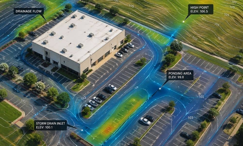
Houston property owners are starting to run into a new kind of problem. It’s not always about building something new. Instead, it often comes down to proving what already exists on the property. Recent stormwater discussions around the Houston area show how things are changing. Fees and reviews now depend on how much hard surface […]
Why Early Transportation Engineering Prevents Project Delays

Fort Worth keeps growing. New stores, new offices, new neighborhoods show up every year. That sounds like progress, and it is. But behind every new project, there’s one thing that often gets ignored at the start: how people will actually get in and out. That’s where transportation engineering comes in. And when it comes in […]
What a Licensed Surveyor Finds Before You Buy Land

Buying land in McKinney looks simple at first. You see a listing, you check the price, and the lot seems ready for a new home or project. However, things rarely match what people expect. A licensed surveyor often finds details that change how buyers think about the property before any money moves forward. McKinney keeps […]