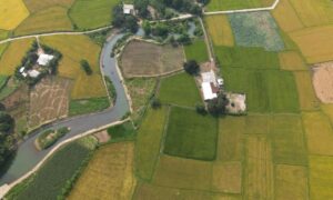
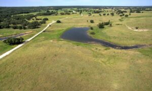
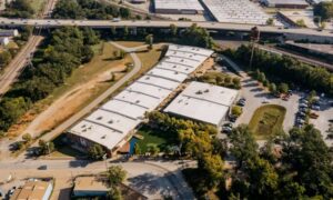
A lot next to a detention basin or drainage channel can look like an easy buy. The ground is dry the day you walk it. The channel nearby seems to move water without trouble. What sits beside a parcel still shapes how you can use it, and some of that never shows up on a quick visit.
A due diligence survey gives you a clearer picture of the site before you put money down. Land near flood-control features carries a few extra things worth checking before you buy. The sections below cover what to look at, and who to bring in, before you close.
Look Beyond the Property Boundary When Flood Control Infrastructure Is Nearby
Buying a parcel and understanding a parcel are two different things. The deed tells you what you own. It does not always tell you what limits how you can build, drain, or reach the land. When a drainage facility sits next door, those limits matter more.
A channel, basin, or floodway improvement near your line can affect how you get to the site and where you can build. Part of the land may fall inside a drainage easement or a dedicated corridor. Those areas often cannot hold a house, a driveway, or fill dirt. On paper the parcel may look full size, but the usable part can be smaller.
What you see on the ground is not the whole story either. A visible channel does not show every recorded interest tied to the property. Some easements and dedications only appear in county records and on a survey. A due diligence survey pulls those together so you know the real shape of what you are buying.
Identify Whether Future Flood Planning Could Affect the Surrounding Area
Public planning records are worth a look before you buy. Cities and drainage districts study where water goes and where problems tend to show up. Those studies can point to spots where future drainage work might happen.
A planned project is not the same as a current restriction on your land. It helps to sort what you find into three groups: plans that have been adopted, projects that are only proposed, and work that is funded and confirmed. Each one carries a different weight. A line on a study map does not mean a bulldozer is coming next year.
New Braunfels has a Drainage Area Master Plan meant to build a better understanding of flood risk across the city. It is also used to spot possible regional flood-control projects. If a parcel sits near one of those study areas, that is a good reason to ask the city more questions before closing.
Examine Access Routes That Could Change During High-Water Conditions
Many buyers ask if the parcel itself is in a flood zone. That is fair. The road to the parcel deserves the same attention.
The way in and out can cross a low-water crossing, a drainage area, or a road that floods during heavy rain. Land that stays dry can still be hard to reach when water rises. For a future home or business, steady access is a real day-to-day concern, and it is easy to miss on a sunny afternoon showing.
A survey can record what exists on the ground now, such as the driveway location, road frontage, and physical features near a crossing. Broader questions, like how often a route floods, usually fall to flood and engineering professionals. Knowing the current conditions gives those experts something solid to work from.
Separate Recorded Site Conditions From Assumptions About Flood Protection
A common mistake is thinking a nearby basin or channel cancels out flood concerns. It does not work that way. A detention pond is built for a set purpose and a set range of conditions. It was made to hold or slow water in a certain way, not to promise dry land next door.
Lean on records instead of impressions. Maps, recorded documents, permits, and professional reports carry far more weight than how the site looks on a clear day. New Braunfels itself points out that the risk of flooding is not limited only to structures inside a designated Special Flood Hazard Area. That area is the high-risk zone drawn on federal flood maps, and land outside those lines can still take on water.
Build a Pre-Purchase Team Before Closing on Land Near Drainage Infrastructure
No single expert answers every question about a parcel near a drainage facility. The right mix depends on the property and your plans for it. A short list of who tends to help:
- A licensed land surveyor for boundary lines, easements, and survey-related evidence.
- Local planning or floodplain officials for the rules that apply to the site.
- A civil or drainage engineer when the property needs a project-specific drainage study.
- Title professionals and legal counsel for recorded interests tied to the land.
Think of a due diligence survey as one piece of a larger review. It answers boundary and site-condition questions well. It does not replace legal, engineering, environmental, or regulatory work. Buyers who line up the right people early tend to face fewer surprises after the sale.
Frequently Asked Questions
What makes a due diligence survey useful for land near a drainage facility?
A due diligence survey can document boundary lines, visible improvements, and survey-related evidence that matters when you look at land near drainage or flood-control features. It can show recorded easements and dedicated areas that a walk-through misses. The right scope depends on the property and the deal, so it helps to talk it through with a licensed surveyor. That way the survey answers the questions your purchase actually raises.
Should a buyer assume a nearby detention pond protects the entire property?
No. A detention pond or other drainage facility does not, on its own, prove that a parcel is safe from all flooding concerns. Each site has its own conditions, and flood-control features are built for a set purpose. Review the flood information and records for that specific property instead of trusting how the pond looks.
Can future flood-control projects affect land that is currently undeveloped?
They can, though every case is different. Public drainage plans may point to possible future projects or improvement areas near a parcel. A plan on paper is not the same as work that is funded and scheduled. Check the current status of any project with the proper public agencies and records before you rely on it.