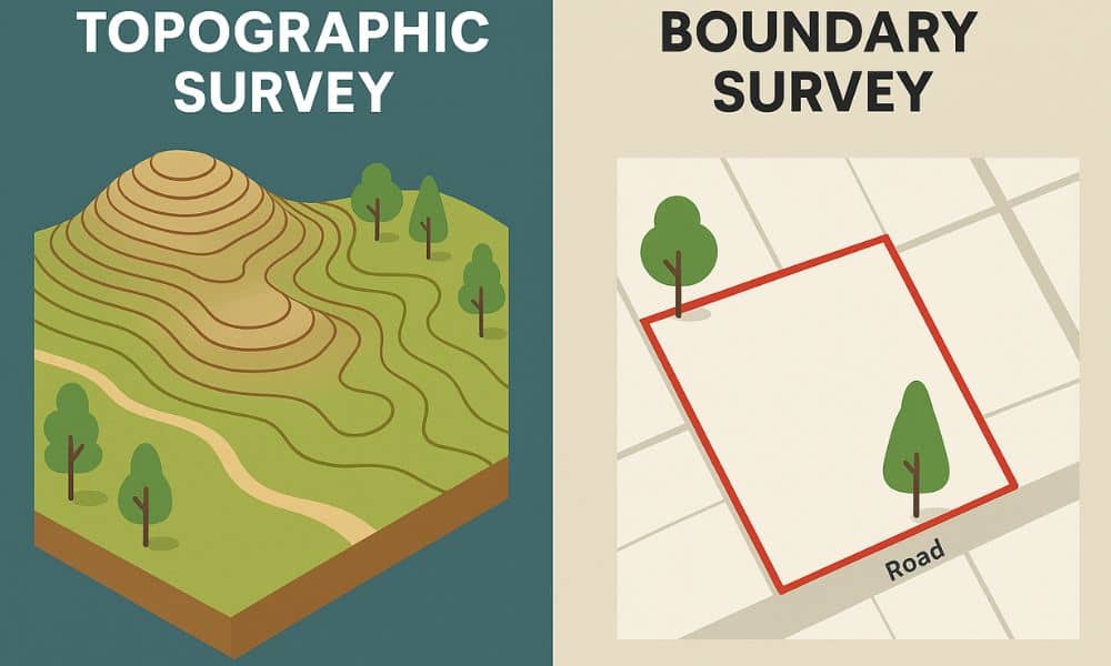
If you’re planning a property project, it’s important to know the difference between a topographic survey and a boundary survey. These are two of the most common land surveys, and while they may sound similar, they serve very different purposes. Whether you’re building a fence, buying land, or preparing for construction, understanding how these surveys work can save you time, money, and legal trouble.
What Is a Topographic Survey?
A topographic survey is used to map the physical features of a piece of land. This includes details like:
- Elevation changes (hills, slopes, dips)
- Natural features (trees, rivers, rocks)
- Man-made structures (buildings, roads, fences)
Surveyors use advanced tools like GPS, total stations, and drones to collect data. The end result is a detailed map that shows the shape and height of the land, which is helpful for engineers, architects, and developers when planning a project.
What Is a Boundary Survey?
A boundary survey focuses on identifying the legal boundaries of a property. It determines:
- Where your land starts and ends
- If there are any encroachments (like a neighbor’s fence crossing your line)
- The exact corners and lines of your lot
These surveys are based on title documents, public records, and physical markers found on the land. A boundary survey is often required for buying property, resolving disputes, or putting up permanent structures near the edge of your lot.
Key Differences Between Topographic and Boundary Surveys
Here’s how these two surveys differ:
| Aspect | Topographic Survey | Boundary Survey |
| Purpose | Shows elevation and features | Establishes legal property lines |
| Used For | Construction, grading, planning | Buying/selling land, resolving disputes |
| Includes | Trees, slopes, buildings, utilities | Property corners, lines, and encroachments |
| Output | 3D maps and elevation models | Legal plats and survey drawings |
When Do You Need a Topographic Survey?
You should get a topographic survey when:
- You’re preparing a construction site
- You need to plan for drainage or grading
- You’re designing roads, buildings, or landscaping
- You want to understand how the land changes in height
This type of survey helps ensure that your design works well with the land and follows any building codes or environmental rules.
When Do You Need a Boundary Survey?
A boundary survey is a smart choice when:
- You’re buying or selling property
- You want to build a fence, garage, or addition
- There’s a dispute with a neighbor about where the property line is
- You’re subdividing land or making legal changes to a parcel
This survey helps protect your property rights and gives you a clear record of your land limits.
Can You Use Both Surveys Together?
Yes, and in many cases, you should. For example:
- New home construction: A boundary survey ensures you build within your lot. A topographic survey helps your team design the foundation, grading, and drainage.
- Subdivision projects: Both types are often required by local building departments.
Using both surveys ensures legal accuracy and better site planning.
How to Choose the Right Survey for Your Project
Here are a few tips:
- Ask: “Do I need to know the land’s legal boundaries or its physical features?”
- If it’s about ownership, start with a boundary survey.
- If it’s about design or construction, start with a topographic survey.
- Talk to a licensed land surveyor who can guide you based on your goals.
Tools and Technology Used in Each Survey Type
- Boundary Surveys: Total stations, metal detectors, deed records, property pins
- Topographic Surveys: GPS units, drones, 3D scanners, and sometimes LiDAR technology
Both rely on accurate measurements, but topographic surveys involve more detailed mapping of surface features.
Cost Comparison: Boundary vs Topographic Survey
Survey costs vary by size, location, and complexity. Here’s a general idea:
| Survey Type | Average Cost |
| Boundary Survey | $500 – $2,000 |
| Topographic Survey | $1,000 – $3,500+ |
Costs may go higher for large lots, rough terrain, or urgent timelines. Always ask for a quote from a licensed land surveyor near you.
Licensed Land Surveyors: Why Qualifications Matter
Only a licensed surveyor can legally perform boundary or topographic surveys. When hiring, be sure to:
- Check for state licensure
- Ask about experience with your type of project
- Request sample reports or references
Hiring the right professional ensures your survey is accurate and legally valid.
Common Mistakes to Avoid When Choosing a Survey
- Choosing the wrong type of survey for your needs
- Assuming your old survey is still valid
- Failing to communicate project goals to your surveyor
- Not checking local permit or zoning requirements
Avoiding these errors helps prevent delays and costly do-overs.
Conclusion: Choosing the Right Survey for Peace of Mind
Both topographic surveys and boundary surveys play critical roles in real estate and construction. One helps you understand the shape and features of the land, while the other defines where the land legally begins and ends. Knowing which one to use—and when to combine both—can help you protect your investment, avoid conflicts, and move your project forward with confidence.
FAQs
Q1: What’s the main difference between a topographic and boundary survey?
A topographic survey maps physical features and elevation. A boundary survey defines legal property lines.
Q2: Do I need both for new construction?
Yes, most construction projects require both types to ensure accurate planning and legal compliance.
Q3: Is one type more expensive?
Topographic surveys tend to cost more due to the added detail and equipment involved.
Q4: Can I use an old survey?
Only if it reflects current site conditions and is approved by your surveyor, lender, or building department.Q5: How long is a survey valid?
There’s no expiration, but surveys become outdated as land conditions or property records change.


