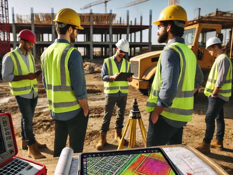
Construction today is more complex, fast-paced, and risk-sensitive than ever. Whether you’re building in the bustling cityscapes of Dallas or planning a new residential development in Bryan, Texas, the early decisions you make can either keep your project on track—or send it spiraling off course. That’s why more builders and engineers are turning to LiDAR mapping as a strategic solution, using its speed and precision to replace outdated survey methods and gain more control from the very start.
Applying LiDAR Throughout Construction Phases
Unlike traditional surveying tools, LiDAR supports the full lifecycle of a project. Here’s a closer look at how it’s used at each major stage:
Pre-Construction: Topography, Site Access, and Risk
Before design begins, builders need to understand what they’re working with. A construction LiDAR survey delivers highly accurate terrain data—mapping slopes, elevation changes, and drainage paths This makes it easier to determine:
- If the land is suitable for development
- Where roads and utility lines should go
- How stormwater will flow during heavy rain
In places like Bryan, where new subdivisions are popping up quickly, LiDAR helps assess larger land parcels without sending teams into the field for weeks.
Design & Engineering: Infrastructure Optimization
Once you have a clear understanding of the land, you can design more confidently. LiDAR supports engineers by feeding into CAD and BIM software, helping to:
- Design roads and drainage systems that match real-world contours
- Spot potential clashes between utilities and structures
- Optimize building placement for cost and safety
In urban areas like Dallas, where space is tight and utility networks are dense, LiDAR ensures nothing is missed.
Active Construction: Progress Monitoring & Safety
LiDAR doesn’t stop once the build begins. Contractors use it to monitor progress in real time. Drone-mounted LiDAR can:
- Compare ongoing work to approved plans
- Catch deviations before they become expensive fixes
- Ensure grading and foundation work is within spec
It also improves safety, especially on large or uneven sites, by keeping survey crews out of harm’s way.
Post-Construction: As-Built Validation & Handover
When the project wraps up, LiDAR can provide a final as-built survey. This gives stakeholders confidence that what was designed matches what was built—down to the inch. These records are also valuable for:
- Permitting and inspection documentation
- Future maintenance and renovations
- Utility mapping for underground lines
Real-World Use Cases in Texas Construction
1. Urban Projects in Dallas: High-Density Site Mapping
In downtown Dallas, vertical builds are the norm. With little room for staging or error, contractors rely on LiDAR for fast, accurate models of existing buildings and tight construction footprints. It helps architects design around obstacles like nearby power lines or existing infrastructure.
2. Land Development in Bryan: Subdivision Planning
Bryan’s growing neighborhoods benefit from LiDAR’s broad area coverage. Developers can scan large tracts of land in hours, then use the data to design roads, lots, and stormwater management systems that fit the land perfectly—saving weeks in the planning phase.
Common LiDAR-Driven Improvements for Builders
LiDAR doesn’t just provide better data—it drives better decisions. Here’s how it makes a real impact on the ground:
1. Time and Labor Reduction During Earthworks
By knowing the exact volume of earth to move, contractors can plan equipment needs and schedules more efficiently—cutting both time and fuel costs.
2. Clash Detection and Interference Minimization
Using LiDAR to visualize underground and above-ground assets reduces the risk of hitting utility lines or building in the wrong place. This is especially valuable in older urban areas with poorly documented infrastructure.
3. Utility Planning and Drainage Design
Accurate surface models support smarter stormwater design, reducing future flooding issues—something especially important in Texas, where sudden storms can overwhelm poorly planned systems.
Challenges Faced Without LiDAR Integration
Skipping LiDAR may save money upfront—but it often leads to bigger problems later.
- Surveying Delays and Budget Overruns – Manual surveys take longer, require more site visits, and are prone to errors. This delays the design phase and adds risk.
- Inconsistent Site Conditions During Construction – Unexpected site features—like uneven grading or unmarked pipes—can derail a build. LiDAR gives you a clearer picture from the start, reducing those “uh-oh” moments.
Elevating Construction Planning with LiDAR
LiDAR mapping isn’t just a tool—it’s a strategy. When integrated throughout the construction lifecycle, it provides clearer data, faster insights, and smarter decisions. In a competitive market like Dallas or a rapidly growing one like Bryan, this technology can give your project the edge it needs to succeed—on time, on budget, and with confidence.
If your team hasn’t adopted LiDAR yet, now’s the time to explore how it can reshape your construction process from the ground up.


