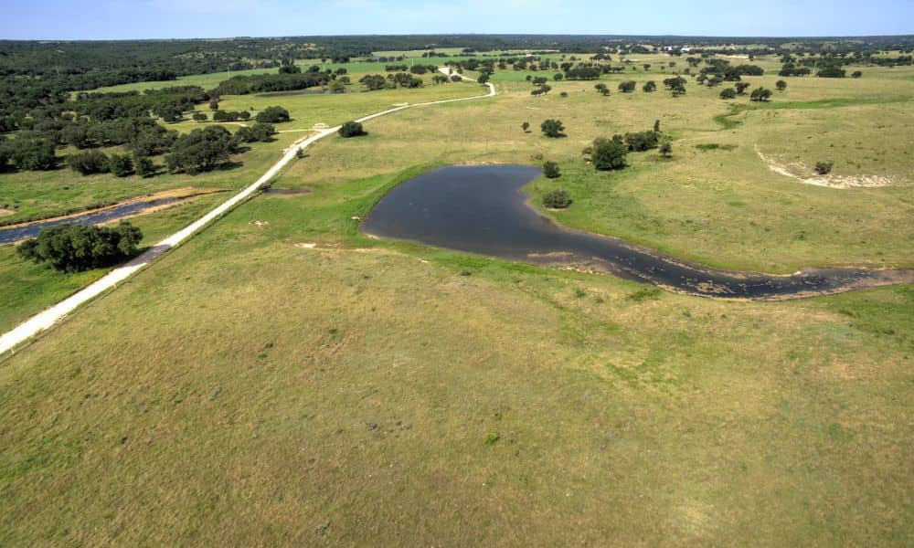
Many ranches carry decades of earthwork that nobody wrote down. Old stock tanks, broken dams, diversion berms and leveled pads from past oil and gas work can sit under mesquite and dry grass for years. These features start to matter when an owner or buyer plans a road, a homesite, a lease or a land sale. LiDAR mapping gives you a detailed model of the ground surface across the whole ranch. With that model you can find old features and decide which ones need a closer look before anyone spends money on dirt work.
LiDAR stands for Light Detection and Ranging. A sensor on an aircraft or drone sends out laser pulses and records how long each pulse takes to bounce back. A survey team turns millions of those measured points into a bare-ground model of the land. On a large ranch, the model shows shapes that are hard to spot from a truck or a fence line.
Identifying Old Tanks and Berms Across West Texas Ranch Terrain
LiDAR mapping picks out old tanks and berms by their shape. An earthen stock tank shows up as a bowl with a raised dam on its low side. A berm looks like a narrow ridge that runs straighter or more evenly than the ground around it.
West Texas ranches often hold two kinds of old features. Ranchers built stock tanks to catch runoff for cattle, and many of those tanks sit dry today behind a worn or breached dam. The region also has a long history of oil and gas work. Old tank battery sites can leave behind a flat pad with a low containment berm around it, and brush can hide both kinds of features even when the earthwork stays in place.
Open ground works in your favor here. Much of West Texas has grassland and scattered mesquite rather than thick forest, so the laser reaches bare ground in most spots. Dense brush patches can still leave thin areas in the data. The survey team should mark those gaps on the map so nobody mistakes them for flat ground.
Reading Elevation Changes Around Abandoned Tank and Berm Areas
The elevation data shows how much each feature rises or dips compared with the ground around it. Contour lines bunch up on the face of a dam and spread out across a flat tank floor. A cross section drawn through a berm shows its height and width in one simple profile.
These numbers help you picture how water moves across the property. A tank dam may still hold back runoff after a heavy storm, even if the tank looks dry most of the year. A breach in the dam shows up as a notch where the crest drops. Water that once pooled in the tank now follows that notch downhill and can cut a new channel toward a road or a building site.
Old pads and berms change water flow too. A containment berm can trap rainwater inside a pad. A long diversion berm may push runoff out of one draw and into another. When an engineer reads these changes early, culverts, grading and road crossings can fit the way the ground actually works today.
Separating Intentional Earthworks From Natural Ranch Terrain
Man-made earthworks usually look more regular than natural ground. Straight edges, even slopes, sharp corners and flat tops often point to a dozer or a scraper. Natural features such as draws, playas and caliche rises tend to have softer and less even shapes.
Some features are harder to call. A shallow natural low spot can look a lot like a stock tank that has filled with silt. An old ranch road bed can resemble a low berm. The survey team can compare the LiDAR with older aerial photos, which often show a tank holding water or a pad in use years ago.
Records help as well. Deeds, easements and lease papers may mention tanks, pipelines or pad sites. The Railroad Commission of Texas regulates oil and gas activity in the state and keeps well records that may point to where tank batteries once stood. These sources can’t stand in for a field check, but together they help sort the map into likely man-made features and likely natural ones.
Deciding Which Legacy Features Need Field Verification
A feature needs field verification when it sits near planned work or could affect safety, drainage or legal rights. A dry tank far from any planned change may only need to stay on the map. A dam above a proposed homesite or a berm across a planned road calls for a crew on the ground.
Features that often move to the top of the field list include:
- Tank dams that sit upslope from roads, pads or homesites
- Breached dams or washouts that now carry runoff across the property
- Old oilfield pads and berms where buried lines, casing or debris may remain
- Berms or tanks close to a property line, fence or easement
- Spots where brush left gaps in the LiDAR data
In the field, a surveyor can check key elevations, locate pipes or spillway structures and tie each feature to the property boundary. LiDAR measures the surface only. It can’t show what sits inside a berm or under a pad, and it can’t confirm soil conditions or contamination. Old oilfield sites may call for an environmental consultant, and some dams may need an engineer’s review before anyone changes them.
Using the Mapping Before Changing or Developing the Ranch
LiDAR mapping does the most good before you set a road, split the land or lease acreage. The terrain model gives your surveyor, engineer and any buyer the same picture of the ground. Everyone works from one set of contours instead of guesses.
Different plans use the data in different ways. A ranch split may need boundary work and access routes that steer clear of old dams. A solar or wind lease may need to know which pads and berms fall inside a proposed layout. A new homesite belongs above any tank that could still hold water, and the map helps you find that spot while changes on paper still cost little.
Before you remove a berm, cut through a dam or fill an old tank, confirm what’s allowed with the right agencies and your advisers. Rules for dams, drainage and former oil and gas sites can depend on the feature, its location and who holds an interest in the land. A licensed surveyor can explain what the map shows, what still needs a field check and which other professionals to call next.