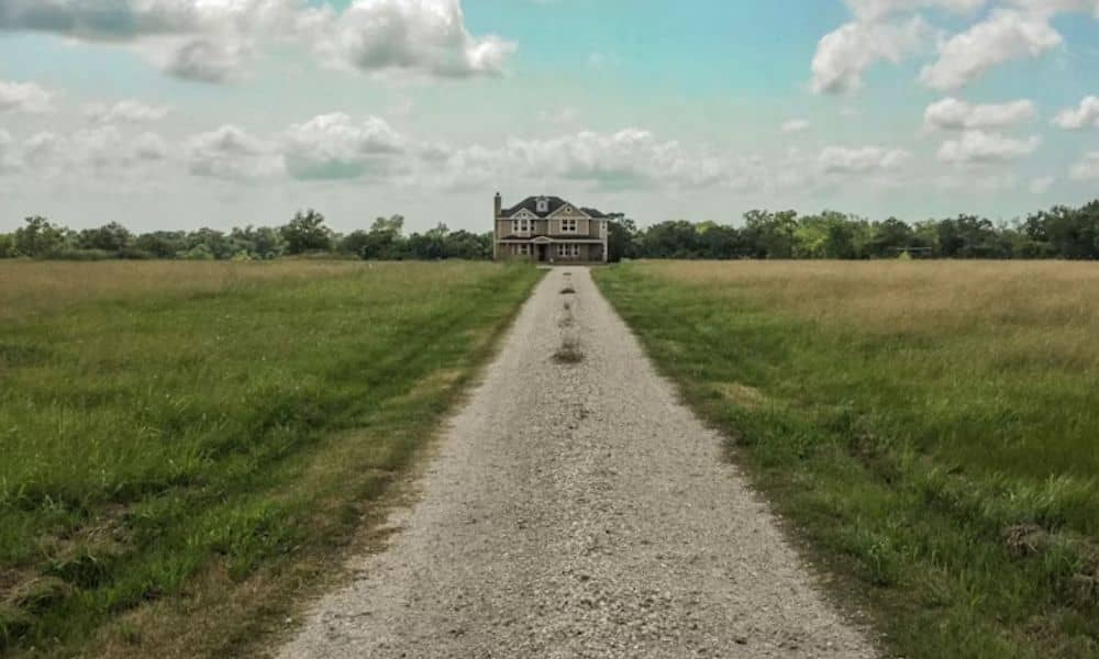
If you own acreage, an old farm road may cross part of your land. Maybe it leads to a neighbor’s pasture. Maybe it’s just a worn path that’s been there for years. Before you build, split the land, or sell it, you need to know what that road really is. A lot survey can answer that question. It shows where the road sits on your land. It also shows if the road matches any recorded easement. And it shows how the road might limit what you can do with your acreage.
Rural roads don’t always match what’s written on paper. That gap between the record and the real world is exactly what a lot survey is built to find.
Why Old Farm Roads Matter on an Acreage Lot Survey
An old farm road isn’t just dirt and gravel. It can be a legal right that someone else holds over part of your land. Or it can be nothing more than habit between neighbors, with no legal weight at all. You can’t tell which one it is just by looking.
A surveyor treats the road as something worth measuring and recording. It can affect your boundary lines. It can affect how much of your land you can actually build on. It can affect your own access rights too. If the road serves a neighboring property, that use might keep going even after you buy the land. If it doesn’t serve anyone else, you may be free to move it, gate it, or remove it. The survey helps you find out which case applies to you.
This matters more on acreage than on a small city lot. Land near Bryan has often been used for farming for many years. People made informal deals about access, and most were never written down. A lot survey turns that old history into a clear, current record you can use today.
Locating the Farm Road Within the Tract
A surveyor starts by measuring the road’s real path across your land. This means marking its width, its curves, and the exact spots where it enters and leaves your property. That measured path then gets tied to your legal description. This tells you how much of your usable land the road actually takes up.
Field crews also look for clues about how long the road has been used. Packed-down soil, worn ruts, added gravel, and fences built around the road instead of through it all point to long-term use. These clues help tell the difference between a road that has real standing and one that’s just the easiest way to cross the property right now.
Finding the road’s exact spot also matters for anything you build later. A new driveway, pond, or fence line all need to avoid a road that turns out to have legal protection.
Comparing Recorded Access With Existing Rural Travel Patterns
Once the road is mapped, the next step is checking it against your deed, past surveys, and county records. Sometimes the recorded easement lines up exactly with the road people actually use. Other times, the road on the ground has shifted from where the old paperwork says it should be. This often happens because it was easier to follow the land than the exact survey line.
This check tells you if you’re dealing with a true legal right of access, or just an informal path that grew out of habit. A recorded easement usually stays in place even when the land changes owners, and it limits what you can do with that strip of ground. A path used casually by a neighbor may carry much less legal weight. Still, long-term use can sometimes create its own kind of claim, depending on the facts.
Land near Bryan often shows this exact gap. Farm access tends to shift over time as fences move, fields change, or a road gets rerouted around a low, wet spot. A lot survey puts a clear picture of today next to whatever the old records say. You don’t have to guess.
Planning Around an Old Road Before Developing Acreage
If you plan to split the tract, add buildings, or bring in utilities, the farm road needs to be part of that plan from the start. A road that turns out to be a real easement can limit where you place a new building. It can also affect where a driveway or a septic system can go. If the road provides access to more than one new parcel, it may shape how a subdivision plat has to be laid out.
Even when the road has no formal legal protection, its physical spot still matters for planning. Grading work, utility trenches, and new fences all need to work around the road, or plan to remove it the right way. Building first and sorting out the road later almost always costs more time and money.
A lot survey gives your engineer, builder, or architect a solid base to design around. They won’t have to guess where the road sits or what it means for your land.
When the Farm Road Requires Additional Due Diligence
Some cases need more than a standard lot survey. If the road serves a neighboring property, and there’s no clear record of the arrangement, you may need a title search or a talk with an attorney. This helps you learn what rights exist and who holds them. This step matters even more if you plan to sell the land, since a buyer’s lender or title company will want the access question settled before closing.
A boundary survey or an easement survey can add more detail than a standard lot survey covers. This is especially true if the road’s exact legal width or center line needs to be pinned down for a future agreement or a dispute. If the road crosses a floodplain or affects drainage nearby, that can bring in extra review too.
If you’re not sure about the road, ask your surveyor about it early. Settling its status now keeps it from turning into a surprise during permitting, financing, or closing.
Frequently Asked Questions
Does an old farm road automatically become a legal easement?
Not on its own. Long-term use can sometimes support a legal claim to access, but this depends on the facts. It often needs a legal review, not just a survey. A lot survey records the physical setup. An attorney can advise on the legal side.
Can I remove a farm road that crosses my property?
It depends on whether the road serves another property with a legal right to use it. If the survey and records show no such right, you likely have more freedom to act. If an easement does exist, blocking or removing the road could cause legal trouble.
Will a lot survey tell me who is allowed to use the road?
A lot survey shows where the road sits and how it relates to your boundary. Figuring out who has a legal right to use it usually takes a review of recorded documents, or a talk with an attorney. The survey records conditions. It doesn’t decide legal rights.