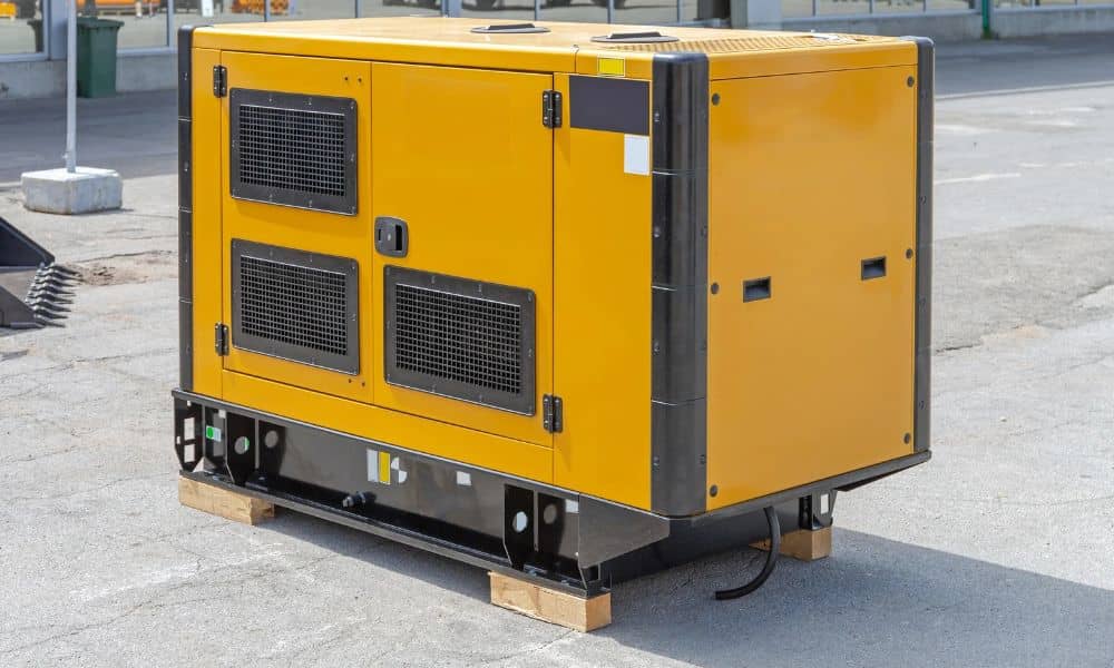
A large standby generator needs more than an open patch of ground. The pad has to sit where water drains away, where nothing blocks the equipment and where service trucks can reach it. A topographic survey shows what the ground really looks like before anyone draws that pad on a site plan.
Backup power gets a lot of attention across North Texas. Millions of Texans lost power during the February 2021 winter storm, and Dallas later approved fixed generators for select libraries and recreation centers. Data centers in the area keep adding big equipment too. One expansion at a Carrollton data center included four 2,250 kW emergency generator sets.
Every project like this starts with the same site question. The team needs to know whether the proposed pad location works with the ground that’s actually there. Good survey data answers that before design money gets spent.
Map Elevation Changes Around the Proposed Generator Pad
A topographic survey measures ground height at many points and turns them into contour lines and spot elevations. Contour lines connect points of equal height. When they bunch up close together, the ground is steep.
For a generator pad, these numbers show how much the ground rises or falls across the footprint and just past it. A large pad needs a level, stable base. If the ground drops two or three feet from one end to the other, the engineer may need fill, cuts or a short retaining wall to make it work.
The surveyor also picks up the edges of nearby pavement, curbs and building slabs. Those points show how the new pad will meet what already exists. The surveyor ties all of it to a vertical datum, which is a shared reference height (usually NAVD 88), so the engineer and contractor read the same numbers.
Capture Drainage Paths Before the Pad Elevation Is Set
Water follows the lowest path across a site, and a raised pad can block that path. The survey records low spots, the direction the ground slopes and drainage features such as inlets, gutters and swales. With that data, the engineer can set a pad height that sheds water instead of trapping it.
Timing matters here. Once someone picks a pad height, changing it later can affect conduit routes, fuel lines and the approach for service vehicles. It’s much easier to adjust a number on a drawing than to break out new concrete.
A pad placed without this data can cause trouble in a hard storm. Runoff that once crossed a lawn freely might pool against the new slab or get pushed toward a building door. If the site sits near a mapped floodplain, the engineer may also compare survey elevations with that mapping, and the rules for equipment in those areas depend on the jurisdiction.
Document Nearby Features That Limit Generator Pad Placement
The ground around a proposed pad usually holds features that shrink the usable space. A topographic survey locates them so the design team knows exactly how much room they have. Features worth capturing often include:
- Building walls, doors, windows and air intakes
- Visible utility structures such as manholes, valves, meters and transformer pads
- Trees, landscape beds and fences
- Retaining walls and steep slopes
- Drive lanes, parking rows and gates that trucks or cranes would use
The survey shows where these features sit. It doesn’t decide how far the generator must stay from them. Clearance and exhaust rules come from the equipment maker, fire codes and local codes, and they vary by project.
One caution applies near the property edge. A topographic survey can show fences and curbs, but it doesn’t establish the legal property line. If the pad may land close to a boundary, ask your surveyor whether the project also needs boundary work.
Give Engineers Enough Survey Data to Compare Pad Locations
The survey should cover every spot the owner might realistically use. Many commercial sites have two or three possible pad areas. When the survey covers all of them, the engineer can compare the options side by side.
Each location brings its own trade-offs. One spot might need less fill, while another offers a shorter cable run to the building’s electrical room. A third might give fuel trucks an easier approach but sit in the path of runoff.
A survey that stops at the edge of a single footprint can leave the engineer guessing. The slope that feeds water toward the pad might start 40 feet away. Extending the survey limits a bit beyond each candidate area often saves the team a return trip to the field later.
Coordinate the Topographic Survey Before Site Plans Advance
Order the topographic survey early, before the site plan moves into final design or city review. Dallas and the surrounding suburbs each run their own plan review, and submittal needs can differ by city and project type. Confirm those requirements with your engineer and the local permitting office before fieldwork starts.
A little prep helps the surveyor set the right scope. Share the rough equipment size, the likely pad areas and any older surveys or as-built drawings you have. Let the survey team know about gated yards, business hours or active loading zones that could affect when the crew can work.
Frequently Asked Questions
How much area should a topographic survey cover around a generator pad?
The right limits depend on where the pad might go and what the engineer needs to see. Most projects benefit from a survey that reaches past the footprint itself. That wider view captures the slopes, drainage and features that affect the pad from the outside.
Can an existing topographic survey be used for a new generator project?
Sometimes it can. Your project team should confirm that the older survey still matches today’s conditions and includes the details the new work requires. New paving, landscaping or equipment added since then may call for updated fieldwork.
Should the generator footprint be known before ordering the survey?
A rough equipment layout or a general target area helps the surveyor and engineer set sensible survey limits. You don’t need a final pad location first. Many owners use the survey itself to help pick the best spot.