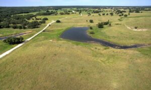
Drive out past the edge of Austin on almost any weekend and you’ll pass a raw dirt lot with a real estate sign leaning in the wind. No fence. No structure. Just grass, a few faded flags, and a buyer somewhere planning what comes next.
Vacant land looks simple. It isn’t. Once the grass grows back or a mower rolls through, the small clues that mark where your property actually starts and stops can vanish in a single afternoon. That’s why land surveyors in your area keep pointing buyers back to one small, unglamorous detail: the corner marker.
Austin’s Vacant Lot Rush Is Erasing Boundary Evidence Faster Than Buyers Realize
Land around Austin is moving fast. Out past the city limits, in places like Hutto, Manor, Leander, and Liberty Hill, raw lots change hands quickly. Builders buy them. Investors flip them. Families hold them for a year or two before building.
That speed comes with a cost. A vacant lot has no fence line to eyeball. No shed corner to line up with. The only real proof of where the boundary sits is a small iron rod or a marked stake in the ground, and those get disturbed constantly.
Mowing crews hit them with blades. Brush clearing knocks them loose or buries them under piles of cut cedar. A neighbor grading their own lot next door can shift or bury a corner without ever knowing it. By the time a new owner walks the property, the marker that once sat right at the corner might be gone, bent, or six inches off from where it started.
None of this is anyone’s fault, exactly. It’s just what happens to small metal objects sitting in open dirt on land that gets worked on constantly. It’s also why a fresh set of eyes from a licensed surveyor matters more on vacant land than on a lot with a house already sitting on it.
The Difference Between a Survey Pin and a True Corner Marker (Most Buyers Confuse the Two)
Here’s where a lot of buyers get tripped up. Not every metal stake in the ground carries the same weight.
A survey pin is often set quickly during a location check. It might be flagged with a piece of ribbon, dropped in to give a rough idea of a line. It’s useful for a fast look, but it was never meant to serve as permanent proof of a boundary.
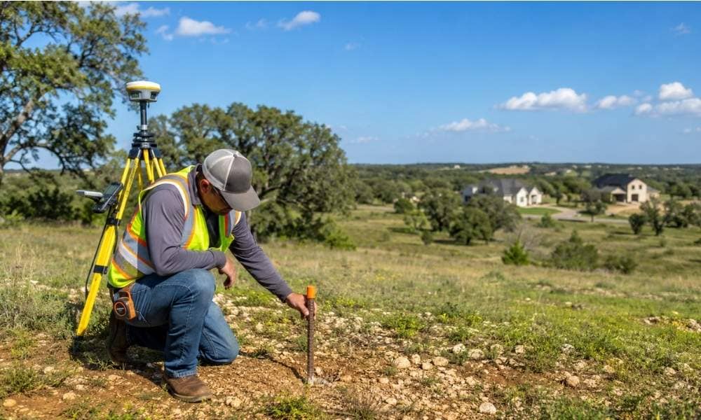
A corner marker, sometimes called a monument, is different. It’s set as part of a full boundary survey, tied to the legal description in the deed, and recorded with measurements a surveyor can reproduce years later. It might be an iron rod driven deep into the ground, or a concrete monument for larger tracts.
The problem is that both can look almost identical sitting in the dirt. A short piece of rebar with a cap on top doesn’t announce which category it belongs to. Buyers who assume any stake they find is legal proof of their line can end up building a fence, a barn, or a driveway in the wrong spot. A licensed surveyor can tell you which kind of marker you’re actually looking at, and whether it holds up as real evidence of where your land begins.
What a Missing Corner Marker Actually Delays at Closing
This is the part most buyers don’t expect. It’s not a footnote. It can hold up an entire deal.
Title companies and lenders like clean answers. On a vacant lot, there’s no fence, no structure, nothing built to confirm where the property lines actually sit. The survey becomes the main proof they have to work with.
When a surveyor goes out to locate the corners for a closing and can’t find the original markers, the job gets bigger. What was supposed to be a quick confirmation turns into a full retracement survey, where the surveyor has to rebuild the boundary from old deed records, adjoining surveys, and whatever physical evidence is still in the ground. That takes more field time and more office time.
For a buyer counting on a closing date, that extra work can push the timeline back by days or weeks, especially if the surveyor needs to pull historical records from the county or track down neighboring surveys to confirm a line. Lenders are usually not willing to fund a loan on vacant land without a clear picture of the boundary. A missing corner is rarely the reason a deal falls apart, but it is a common reason closings get pushed later than planned.
How Central Texas Soil Conditions Affect Which Markers Hold Up Over Time
Austin sits on ground that doesn’t sit still. A lot of the soil around the area contains caliche, a hard, chalky layer that can shift with moisture changes. Mixed in with that, in many spots, is expansive clay, the kind that swells when it’s wet and shrinks hard when it dries out.
That movement is rough on anything set shallow in the ground. A short marker driven just a few inches down can tilt, heave, or work its way loose over a few dry-wet cycles. It might still be there, but it’s no longer sitting exactly where it was placed.
This is part of why local surveyors don’t treat every marker the same way. In areas known for heavy clay movement, they’ll often set iron rods deeper than the minimum, or use a concrete monument instead of a simple rod, specifically because shallow markers don’t hold their position well in this kind of ground. A surveyor who works Central Texas regularly knows which parts of the county tend to shift the most, and adjusts the marker depth and material for that spot rather than using the same approach everywhere.
Why Land Surveyors in Your Area Recommend Setting New Markers Before You Fence, Clear, or Build
Vacant land gives you nothing to check your work against. There’s no existing fence to build off of, no old foundation line to trust. That’s exactly why the timing of a survey matters so much.
If you’re planning to clear brush, fence the property, or start any kind of construction, the smart move is to have a surveyor confirm or reset the corners first, not after the work is done. Once a fence goes up along the wrong line, or a contractor starts grading based on a guess, moving it later gets expensive fast. Fixing a boundary mistake after construction almost always costs more than checking it before.
This is the reasoning behind why land surveyors in your area keep steering buyers toward this step early, before the brush is cleared and before the fence posts go in. It’s a small piece of the process, but it’s the one piece that everything else on a vacant lot gets measured against.