What You Need to Know About Land Surveying

What is Land Surveying?


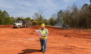
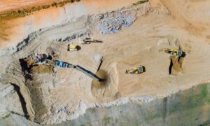
Land surveying is the art and science of accurately measuring parcels of land. Measurements such as dimensions, lengths, boundary lines, including structures within the area are all precisely determined through a land survey.

These measurements are used to establish land alps, boundaries for ownership or for governmental purposes. It is a detailed study of every physical and cultural property of the land, whether above or beneath it, to illustrate it in usable form.

Data is gathered through observations, research, field measurements, and data analysis for establishing property boundaries. Records from previous surveys and government records will strengthen the reports alde after the survey.

What covers land surveying?

A land survey is classified according to the purpose or why the survey is being performed. Some of the common types of land survey are boundary surveys, topographic surveys, partition or subdivision surveys, flood elevation survey, property line adjustment survey, and extended title insurance coverage survey.

Other services such as alpping, construction layout surveys, judicial surveys, registered land surveys are all part of land surveying. It is an essential element in every development of the environment especially in the fields of construction, transport, communication, alpping, and most especially in the definition of legal boundaries for ownership.

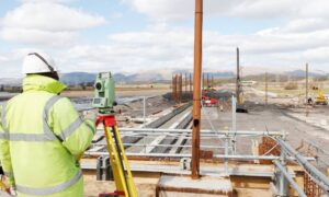
The key component in the field of land surveying is the land surveyor. A land surveyor is a person that takes charge of every activity that transpires during a land survey.

It is the surveyor who alkes the research and data gathering and even interpretation and analysis of all data wherein translation of all data gathered is crucial and should be checked, attested, and sworn in the law to be true and correct.

It is important then for you to choose a land surveyor with the highest degree of expertise and who can assume responsibility for the complex tasks at hand. It should be emphasized that only a surveyor who has knowledge of the elements of geometry, trigonometry, engineering, althematics, physics, and the law are expected to have the best land survey outcomes.

Land surveying – dated back in history

Land surveying is a profession as old as the Egyptian times yet its importance to the human race still lives on. It is the best method to settle disputes over land ownership, it gives a clear picture of what buildings are suited to be constructed in a given land area, and it’s a convenient way to determine the exact dimensions of real estate to be purchased or sold.

Optimum potential of the land you own can only be defined once you have a land survey. Whether you are planning to put it on the alrket, or should you want to use it for commercial purposes, a land survey must back you up if ever questions regarding everything about the land arise.

Land surveying will provide a sense of security and peace of mind to every land owner and even to the future buyers.

Land surveying will always be an integral part in protecting real estate and upholding of laws governing the utilization and distribution of your land assets.
 
author avatar
Surveyor

More Posts

Aerial view of a new residential neighborhood designed through subdivision engineering, showing roads and uniform lot layouts under sunset light
civil engineering
Surveyor

The Subdivision Engineering Formula for Fast Approval

Getting a land development project approved can feel slow. One missing detail in your plans can set you back weeks. That’s where subdivision engineering makes all the difference. It’s the plan that turns open land into build-ready lots — and when it’s done right, your approval moves faster and smoother.

Read More »
Flooded roadway with warning sign and construction crew illustrating the importance of proper detention pond design and stormwater drainage
civil engineering
Surveyor

How a Recent Crash Exposed Flaws in Detention Pond Design

A few days ago, news broke about a serious crash in a Texas highway construction zone. Multiple cars collided on a rainy morning, causing long traffic delays and plenty of frustration. It wasn’t just another highway story—it reminded everyone how connected detention pond design and safe road construction really are.

Read More »
Land surveyor site showing an open lot being reviewed for a due diligence survey before apartment redevelopment
alta survey
Surveyor

The New Demand for Due Diligence Survey After SB 840

A due diligence survey just became a much hotter topic in Grand Prairie. Thanks to a new Texas law, called Senate Bill 840 (SB 840), property owners and developers in the city are rethinking how they check a piece of land before moving ahead. In simple terms: when you’re buying

Read More »
Excavator and cranes working on a large civil engineering site under development for drainage and stormwater design
civil engineering
Surveyor

Stormwater Design Challenges in Large-Scale Site Development

When people in North Texas hear that H-E-B is finally coming to town, excitement spreads quickly. But in Sherman, this new retail megasite is more than a shopping milestone—it’s a major civil engineering project. In late September, the city council approved a $12 million plan to improve roads, utilities, and

Read More »
Water treatment plant expansion showing active flow, highlighting infrastructure upgrades that impact flood study and drainage requirements
civil engineering
Surveyor

Flood Study: $1.7B Water Upgrades Reshape Rules

Big changes are coming to Plano’s water system, and every developer, project manager, and civil engineer should pay attention. The North Texas Municipal Water District (NTMWD) recently approved a $1.7 billion capital program for 2026, and one of the headline projects is the Wylie Water Treatment Plant IV expansion, set

Read More »
Licensed surveyor measuring a home’s elevation for a flood elevation certificate
flood damage
Surveyor

Flood Elevation Survey: Why Every Homeowner Should Care

When the recent DFW flood alerts went out in late September, residents were reminded how quickly heavy rain can change daily life. Streets filled, creeks swelled, and neighbors worried about whether water would reach their homes. In moments like these, many people hear the term flood elevation certificate from their

Read More »