As Austin continues to grow and evolve, the city faces a unique challenge: how to add new buildings and infrastructure without losing the character of its historic neighborhoods. In this delicate balance, LiDAR mapping in Austin TX is becoming an important planning tool. By capturing precise elevation and surface data, LiDAR helps planners, architects, and preservationists make decisions that respect both the old and the new—ensuring growth doesn’t come at the cost of cultural heritage.
Growth and Preservation: A Fine Line in Austin
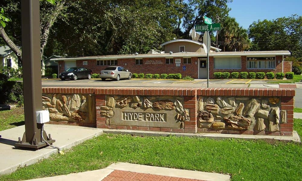
In neighborhoods like Clarksville, East Austin, and Hyde Park, historic charm is part of the community identity. But new development brings taller buildings, wider streets, and underground utilities that can disrupt historic patterns if not carefully managed.
Balancing these needs isn’t just about rules—it’s about visibility, compatibility, and respecting the character of a place. That’s where LiDAR can help—not to stop growth, but to shape it.
Mapping Old Meets New: How LiDAR Enhances Contextual Planning
LiDAR doesn’t just map elevation—it captures the full surface of the city, including:
- Rooflines of existing historic structures
- Tree canopies and fences
- Street slope and sidewalk contours
- Window heights and parapet lines
With this information, planners and developers can test how new construction will look and feel next to older structures, long before anything is built. This makes it easier to maintain a consistent character and scale in historic districts.
3D Models and Elevation Data for Historic Districts
In preservation zones, even a few feet in height can change how a building fits—or stands out—in a neighborhood. Elevation-based building analysis using LiDAR elevation models provides extremely accurate data to:
- Compare proposed buildings to surrounding rooftops
- Analyze step-backs and massing transitions
- Guide roofline alignment and facade rhythm
This precision helps reduce conflicts at design review meetings and increases public trust in development outcomes.
Preventing Unintended Impacts on View Corridors and Streetscapes
Austin protects several important views of landmarks like the Texas Capitol. These view corridors rely on accurate elevation and sightline mapping. LiDAR is already used to:
- Confirm compliance with height caps
- Simulate how buildings may block or protect views
- Ensure new additions do not overpower skyline silhouettes
In addition, it supports planning for streetscape continuity, helping ensure sidewalks, benches, and lighting remain compatible with historic aesthetics.
How LiDAR Mapping Guides Real-World Design Decisions
Recent downtown and East Side projects have used LiDAR-supported preservation planning in Austin to evaluate shadows, roofline visibility, and curb alignment in historic areas.
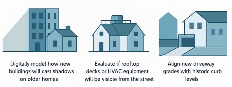
This kind of terrain-based site analysis in Austin supports smarter preservation decisions without halting new investment.
Supporting Overlay Zones and Preservation Boundaries
Overlay zones set rules for development in historic areas, often with specific height, width, and material standards. LiDAR helps:
- Define those zones more accurately using terrain and building data
- Track changes to structure locations or footprints over time
- Inform site-specific decisions based on real-world topography
This creates a more dynamic, data-supported preservation framework.
Challenges with Integrating LiDAR in Preservation Workflows
Despite its advantages, challenges remain:
- Some preservation review boards may lack tools or training to read LiDAR files
- LiDAR data is powerful but needs interpretation to support design nuance
- High-resolution datasets require technical support and software access
Still, as more cities adopt GIS-based planning tools, these barriers are becoming easier to overcome.
The Future of Historic Urban Planning with Spatial Intelligence
Austin’s blend of old and new doesn’t have to be at odds. By using smart tools like LiDAR mapping, the city can continue to grow while maintaining the personality of its historic roots. As more overlay zones, view corridors, and character studies rely on 3D data, LiDAR will likely become a standard—not just for engineers, but for preservationists, architects, and planners alike.
FAQs
1. Is LiDAR used in historic preservation reviews?
Yes. It helps evaluate height limits, shadows, and street alignment in sensitive zones.
2. Can LiDAR help protect Austin’s view corridors?
Absolutely. It’s used to model skyline sightlines and confirm development compliance with Capitol View Corridors.
3. Does LiDAR support preservation overlays?
Yes. It helps define and monitor boundaries with accurate, terrain-aware data.
4. Is LiDAR data too technical for review boards?
It can be, but most outputs are now visual and accessible through GIS portals or 3D viewers.
5. How accurate is LiDAR for building preservation?
LiDAR captures surface features within inches, ideal for evaluating rooflines, setbacks, and elevations.
6. Does LiDAR mapping prevent development?
No—it enables smarter design decisions that respect the historic character of an area.
