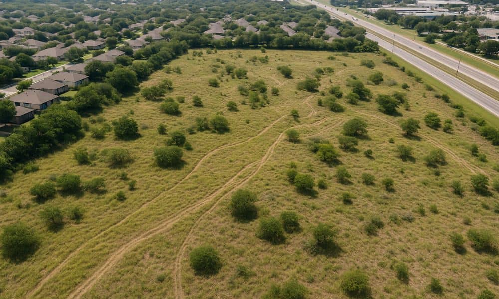
An elevation certificate is one of the most important tools for evaluating how water flows across a property before land clearing begins. In San Antonio, TX, slopes, low areas, and natural runoff paths are common due to the city’s varied terrain. Failing to understand these features early can lead to erosion, drainage issues, or permit delays. This article explains how elevation data supports smart clearing decisions and how obtaining accurate documentation at the start can prevent costly setbacks.
Recognizing the Impact of Slope and Runoff in Pre-Clearing Conditions
Natural land features shape how water drains during and after rainfall. Without knowing where that water naturally flows, clearing or grading could redirect runoff in ways that create problems for nearby properties, streets, or future buildings.
In San Antonio’s hilly and irregular landscape, these risks are especially important to address. Altering the land without evaluating existing grades may result in runoff moving toward foundations, roadways, or drainage systems unprepared to handle it.
Gathering Pre-Clearing Elevation Data to Identify Drainage Flow
An elevation certificate provides accurate benchmarks that show how the land is shaped before any clearing begins. This includes:
- Locating high and low points
- Mapping natural channels and swales
- Identifying poorly draining areas during seasonal storms
Using this data, contractors and engineers can plan grading in ways that work with—not against—natural drainage patterns.
Preventing Drainage Problems Through Early Planning Decisions
Conducting a pre-construction drainage evaluation using elevation data reduces the chances of erosion, flooding, or failed inspections during site preparation. Properties with steep slopes or natural depressions may require special attention or erosion controls.
This step supports teams by helping them:
- Select appropriate tree-clearing paths
- Avoid disturbing sensitive drainage zones
- Install silt fencing or buffers in high-risk areas
These decisions can improve site stability and project timelines.
Coordinating Elevation Certificate Use with Grading and Clearing Teams
Once elevation benchmarks are verified, they should be shared across the site preparation team. Grading crews use this information to stay within design tolerances and avoid unnecessary excavation or over-cutting.
With certified elevation data, teams can:
- Define buildable areas
- Mark zones that should not be cleared
- Avoid disturbing protected runoff paths
Everyone works from the same reference points, which reduces confusion and risk during clearing.
Supporting Compliance with San Antonio Stormwater and Land Disturbance Rules
The City of San Antonio enforces regulations around land grading and runoff management. An elevation certificate can help your project meet these requirements by supporting accurate site plans and permit applications.
This documentation helps:
- Demonstrate that your design respects natural water flow
- Prevent code violations tied to redirected runoff
- Strengthen clearing permit or disturbance applications
Skipping this step could result in fines or stop-work orders—issues that are both avoidable and costly.
Retaining Elevation Records for Ongoing Development and Drainage Adjustments
Even after land is cleared, a certified elevation survey in San Antonio remains valuable. It provides a reliable reference for future development phases, drainage improvements, and structural alignment. Keeping this data on hand helps ensure consistency and reduces the risk of costly rework.
Certified elevation data helps you:
- Avoid rework during inspections
- Align future grading with original plans
- Track elevation changes across the full project lifecycle
Our team can help you secure and maintain this data for long-term use.
Frequently Asked Questions
1. Why is elevation review needed before land clearing?
It identifies slope, drainage paths, and flood risks so clearing doesn’t create new runoff issues.
2. Who uses the elevation certificate during land clearing?
Engineers, surveyors, grading crews, and city officials all use this data for planning and approvals.
3. Can it help with erosion control?
Yes. Knowing the terrain helps teams place erosion controls in the most effective areas.
4. Is an elevation certificate required in San Antonio for clearing permits?
Often, yes—especially for projects near drainage corridors or in regulated zones.
5. Do you help provide the necessary elevation certificate?
Yes. We provide certified elevation documentation that meets San Antonio’s planning and permitting standards.


