East Montgomery County’s New Convention Center to Boost Business & Growth

East Montgomery County Improvement District
Rendering courtesy of the East Montgomery County Improvement District

The East Montgomery County Improvement District (EMCID) has launched an exciting new project—a $130 million convention center in Valley Ranch Town Center, New Caney, Texas. This modern facility will boost the local economy, attract business tourism, and create new opportunities in real estate and infrastructure development.

A Vision for Growth in Valley Ranch

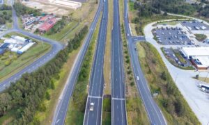
Located at Grand Parkway (SH 99) and I-69, the new convention center will be a key business and entertainment hub in Greater Houston. It offers easy access to Downtown Houston, The Woodlands, and George Bush Intercontinental Airport, making it a prime spot for conventions, trade shows, and corporate events.

As reported by the Houston Chronicle, this development will help East Montgomery County compete with top business districts in Texas by providing a modern space for large-scale events.

Convention Center Features

his 210,000-square-foot facility will include:

✅ 55,000-square-foot ballroom/exhibit hall
✅ Nearly 20,000 square feet of meeting space
✅ 25,000 square feet of pre-function and lobby areas
✅ Outdoor courtyards and entertainment spaces
✅ Attached 813-space parking garage
✅ Future expansion for a full-service hotel

Construction began in January 2025, and the convention center is expected to open by October 2026.

Economic Impact: A $1.73 Billion Boost

The project is expected to have a significant impact on the local economy, with projections including:

📌 533 direct and indirect jobs created
📌 $1.73 billion in new spending over 30 years
📌 $35.1 million in hotel, sales, and venue tax revenue

These figures highlight the long-term economic benefits of the convention center, making New Caney a more attractive location for businesses and tourism.

Supporting Developments in Valley Ranch

The convention center is part of a larger expansion of Valley Ranch Town Center, which also includes:

  • Lumos Entertainment Venue: A 45,000-square-foot entertainment center featuring bowling, laser tag, axe throwing, and arcade games (Opening Spring 2025).
  • The Marketplace: A 188-acre shopping and retail center with outdoor dining and a mix of national and local retailers (Construction begins 2026).

These developments will enhance the area’s appeal, making it a desirable destination for business, entertainment, and shopping.

Opportunities for Land Surveying and Infrastructure Development

With such large-scale construction underway, land surveyors play a crucial role in ensuring:

✔ Proper land grading and site preparation
✔ Boundary assessments and zoning compliance
✔ Utility planning and infrastructure layout

As New Caney continues to grow, surveying professionals will be in high demand for future developments, including road expansions, commercial projects, and residential growth.

A Bright Future for East Montgomery County

The Valley Ranch Convention Center is set to transform East Montgomery County into a leading business and event destination. With its strategic location, state-of-the-art facilities, and economic benefits, this project marks the start of a new era of growth and development.

author avatar
Surveyor

More Posts

Excavator and cranes working on a large civil engineering site under development for drainage and stormwater design
civil engineering
Surveyor

Stormwater Design Challenges in Large-Scale Site Development

When people in North Texas hear that H-E-B is finally coming to town, excitement spreads quickly. But in Sherman, this new retail megasite is more than a shopping milestone—it’s a major civil engineering project. In late September, the city council approved a $12 million plan to improve roads, utilities, and

Read More »
Water treatment plant expansion showing active flow, highlighting infrastructure upgrades that impact flood study and drainage requirements
civil engineering
Surveyor

Flood Study: $1.7B Water Upgrades Reshape Rules

Big changes are coming to Plano’s water system, and every developer, project manager, and civil engineer should pay attention. The North Texas Municipal Water District (NTMWD) recently approved a $1.7 billion capital program for 2026, and one of the headline projects is the Wylie Water Treatment Plant IV expansion, set

Read More »
Licensed surveyor measuring a home’s elevation for a flood elevation certificate
flood damage
Surveyor

Flood Elevation Survey: Why Every Homeowner Should Care

When the recent DFW flood alerts went out in late September, residents were reminded how quickly heavy rain can change daily life. Streets filled, creeks swelled, and neighbors worried about whether water would reach their homes. In moments like these, many people hear the term flood elevation certificate from their

Read More »
Surveyor using total station for boundary survey at a road construction site
boundary surveying
Surveyor

Boundary Survey Demand Rises as Projects Break Ground

If you live in Midland, you can see how busy the city has become. Roads are being widened, new subdivisions are taking shape, and utility crews are everywhere. At the same time, the oil and gas sector is facing fresh rules and tighter checks. With so much happening, one service

Read More »
Construction survey equipment on a tripod at a highway project site with workers and traffic in the background
construction
Surveyor

Construction Survey Challenges in Major Infrastructure Projects

If you live in Austin, you’ve probably heard the big news: the I-35 Capital Express Central project is officially reshaping traffic, trails, and daily routines. The beloved Butler Hike-and-Bike Trail, which thousands of Austinites use every week, has been rerouted for years to make way for highway construction. For joggers

Read More »
Drone land surveying being used to create a detailed 3D map of a cave system with a surveyor controlling the drone.
land surveying
Surveyor

How Drone Land Surveying is Mapping Hidden Spaces

What if you could explore a cave without actually going inside? Thanks to drone land surveying, that’s now possible. The Texas Department of Transportation (TxDOT) recently used drones to create a detailed 3D map of the Inner Space Cavern near Georgetown, Texas. This project is changing how land surveying is

Read More »