How LiDAR Mapping Helps Document Drainage Conditions
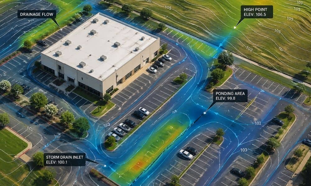
Houston property owners are starting to run into a new kind of problem. It’s not always about building something new. Instead, it often comes down to proving what already exists on the property. Recent stormwater discussions around the Houston area show how things are changing. Fees and reviews now depend on how much hard surface […]
LiDAR Elevation Models Reshape Zoning in Texas Cities
As cities evolve and development expands into more varied terrain, elevation has become a critical factor in how zoning rules are written and applied. Whether it’s managing height restrictions, floodplain boundaries, or buildable land on sloped lots, planners increasingly rely on precise elevation data to make informed decisions. In places like Dallas and San Antonio, […]
How LiDAR Mapping Improves Construction Planning
Construction today is more complex, fast-paced, and risk-sensitive than ever. Whether you’re building in the bustling cityscapes of Dallas or planning a new residential development in Bryan, Texas, the early decisions you make can either keep your project on track—or send it spiraling off course. That’s why more builders and engineers are turning to LiDAR […]