If you follow land news, you probably saw the story about the “corner-crossing” case that reached the U.S. Supreme Court. It involved hunters, a private ranch, and a tiny survey corner that created a massive debate across the country. At first, it may seem far from Bryan, Texas, but it actually connects to something many landowners deal with: the accuracy of a boundary line survey. This case shows how one small survey point can affect access, ownership, and real decisions people make about their land.
The ruling pushed more people to look at how survey corners shape rights, movement, and property use. If you plan to buy land, split a tract, build a driveway, or lease land for hunting, this case has lessons for you.
A Supreme Court Case Built Around One Survey Corner
The whole story began in Wyoming. Four parcels met at a single corner. Two belonged to the public, and two belonged to a private ranch. A group of hunters used GPS to step from one public parcel to the next by hopping over that shared corner. They never stepped on the ranch owner’s land. They just crossed the corner in a diagonal motion known as corner crossing.
The ranch owner argued they trespassed through “airspace.” The hunters said they stayed on public land. After several rounds in court, the Supreme Court decided not to take the appeal. That left the earlier decision standing, and people everywhere began talking about what it means for access and property rights.
This case shows something simple but powerful: survey corners often control what people can or cannot do on the land.
Survey Corners Carry More Weight Than Most People Think
Most people imagine property lines as long, clear edges, but surveyors know everything depends on corners. Corners show the true start and end of your land. A single monument or pin can decide where you walk, where you build, and how others move around you.
The corner-crossing case made this obvious. A tiny point on the ground became the center of a national conversation about rights and movement.
In Brazos County, the same idea applies. Many rural parcels meet at odd angles or narrow points. Some tracts touch only at corners. When you depend on a single point to define access or ownership, accuracy matters more than ever.
Why the Case Still Matters in Texas
Texas uses metes and bounds, not the grid system seen in states like Wyoming. Even so, the same types of problems show up here in different ways. Bryan and the surrounding areas include land with:
- Shared corners between large tracts
- Trails that connect only at a point
- Hunting lease boundaries that depend on accurate corners
- Access routes for landlocked parcels
- Corners hidden in thick brush or wooded areas
These situations highlight why it helps to confirm your corners with a current boundary line survey. A mistake in one point can shift a whole access route or change how people reach different parts of the land.
How This Impacts Your Next Boundary Line Survey in Bryan
Access Routes Need More Attention. Some land in Bryan and rural Brazos County has limited frontage. Landowners rely on easements or access paths that begin or end at a corner. If the corner has the wrong position, the access route can shift onto someone else’s land. A boundary line survey gives you the true location before you build a road or negotiate access.
Hunting and Recreation Can Depend on Corners. Hunting is popular in this area, and many owners lease out parts of their land. A misplaced corner can confuse hunters about where they can travel. Clear markers help everyone stay on the right property and avoid conflict.
Land Splits Need Exact Corners. Families often divide land for children or future building sites. If those new tracts meet at corners, everyone needs the correct positions. A boundary line survey protects each person’s share and keeps the split fair.
Utility Work Follows Property Lines. Water lines, electric co-ops, and broadband projects often run along land boundaries. A wrong corner can place a utility line on the wrong tract. Confirming your corners helps crews follow the right path and prevents delays.
Why Now Is the Best Time to Check Your Corners
The corner-crossing case made people more aware of how small survey details can shape big decisions. With more eyes on property rights, landowners everywhere want certainty. Modern tools like GPS can reveal errors older surveys missed, so it helps to update your records.
A boundary line survey gives you:
- Correct corner positions
- Clear maps for planning
- Solid proof for agreements
- Confidence during sales
- Protection during land leases
- Peace of mind for long-term ownership
Because so many land decisions now depend on exact corner placement, many landowners want to secure precise boundary measurements before moving ahead with building, leasing, or dividing land. When your corners are verified, it clears up confusion early and stops arguments before they even start.
What Happens During a Boundary Line Survey

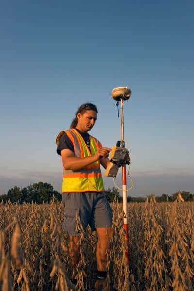
A surveyor looks at past records, compares old descriptions, and finds the real corner locations on the ground. They check markers, take accurate measurements, and set new points when needed. They also map the boundary so you have a document you can trust. This process keeps your land history clear and accurate.
Surveyors use a mix of skills and tools, including field equipment, research, and professional judgment. The final product is a clear map that tells you exactly what you own and where it begins and ends.
One Corner Can Change a Lot
The Supreme Court case shows how one small point can change access, rights, and the way people move across land. Even though the case happened far from Texas, the lesson fits Bryan perfectly. Corners are not just tiny dots on the ground. They are legal anchors that shape how you use your land.
Before you add a driveway, rent out hunting rights, split a tract, or settle a question about access, make sure your corners are right. A boundary line survey protects you from problems and gives you a clear path forward.
If one corner can make national news, your own corners deserve the same level of attention.


