Avoid Survey Gaps: Get a Boundary Survey

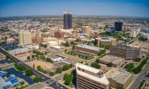
boundary survey - Skyline of Houston, Texas with green spaces and residential areas, highlighting the importance of accurate boundary surveys for property owners.

Buying land in Texas is exciting! Whether it’s for your new home, an investment, or some land to build on, it’s a big deal. But many people don’t know this: if you don’t get a boundary survey, you might have big problems later.

What Are Survey Gaps and Overlaps?

Do you really know where your property ends and your neighbor’s begins? Sometimes, the lines aren’t clear.

  • Survey gaps happen when there is a little empty space between two properties — land that no one really owns because old surveys don’t match up.
  • Overlaps happen when two people both think the same land belongs to them.

These problems happen because Texas uses a system called “metes and bounds.” It describes land using natural things like trees or rivers — but those things can move or disappear over time. So what your deed says might not match what’s actually on the ground.

Cheap Land? Be Careful!

If you’re looking at cheaper land in places like Trinity County or other rural areas, watch out. These lands often have old surveys that might have mistakes. You could buy land that isn’t really yours or miss land you thought you owned.

This can lead to expensive problems, like legal fights or delays in building.

What About Houston?

You might think this only happens in the countryside, but Houston has this problem too.

Many Houston neighborhoods had surveys done many years ago. With all the growth and changes, property lines can get confusing. People have had problems with fences, driveways, and property borders.

Without a good boundary survey, your building permits might get delayed, or you could have fights with neighbors.

A Real Story from Houston
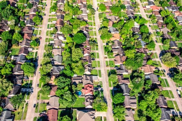
Aerial view of residential neighborhood in Houston, Texas, highlighting how property line disputes can occur between closely built homes.

In 2023, a Houston homeowner found out their backyard fence was actually on their neighbor’s land — by about 10 feet! The fence had been there for 15 years, but an old survey didn’t show the real property line.

This caused a legal fight, delayed their home plans, and cost thousands of dollars in lawyer fees and a new survey.

This shows why it’s so important to get a new, professional boundary survey. It can save you money, time, and stress.

How a Boundary Survey Helps You

A boundary survey is more than just a map. It shows exactly where your land starts and ends.

A licensed Texas surveyor will:

  • Use tools to find your exact property lines
  • Find any gaps or overlaps before you buy or build
  • Give you official papers that protect your land rights

This can stop future problems, court fights, and delays.

When Should You Get a Boundary Survey?

  • Before you buy land — so you know what you’re really getting
  • Before you build — so you don’t build on someone else’s land
  • If there’s a dispute — so you have proof of your boundaries

Don’t Risk Losing Money or Time

Whether you’re buying cheap land in Trinity or a house in Houston, a boundary survey is a must.

It might seem like an extra cost, but skipping it can cost you way more in the long run.

Ready to Protect Your Land?

Don’t wait until you have a problem. The smartest move you can make is to order a boundary survey  before buying, building, or settling a land dispute. A licensed professional will help you avoid surprises, protect your property rights, and give you peace of mind from day one.

author avatar
Surveyor

More Posts

Aerial view of a new residential neighborhood designed through subdivision engineering, showing roads and uniform lot layouts under sunset light
civil engineering
Surveyor

The Subdivision Engineering Formula for Fast Approval

Getting a land development project approved can feel slow. One missing detail in your plans can set you back weeks. That’s where subdivision engineering makes all the difference. It’s the plan that turns open land into build-ready lots — and when it’s done right, your approval moves faster and smoother.

Read More »
Flooded roadway with warning sign and construction crew illustrating the importance of proper detention pond design and stormwater drainage
civil engineering
Surveyor

How a Recent Crash Exposed Flaws in Detention Pond Design

A few days ago, news broke about a serious crash in a Texas highway construction zone. Multiple cars collided on a rainy morning, causing long traffic delays and plenty of frustration. It wasn’t just another highway story—it reminded everyone how connected detention pond design and safe road construction really are.

Read More »
Land surveyor site showing an open lot being reviewed for a due diligence survey before apartment redevelopment
alta survey
Surveyor

The New Demand for Due Diligence Survey After SB 840

A due diligence survey just became a much hotter topic in Grand Prairie. Thanks to a new Texas law, called Senate Bill 840 (SB 840), property owners and developers in the city are rethinking how they check a piece of land before moving ahead. In simple terms: when you’re buying

Read More »
Excavator and cranes working on a large civil engineering site under development for drainage and stormwater design
civil engineering
Surveyor

Stormwater Design Challenges in Large-Scale Site Development

When people in North Texas hear that H-E-B is finally coming to town, excitement spreads quickly. But in Sherman, this new retail megasite is more than a shopping milestone—it’s a major civil engineering project. In late September, the city council approved a $12 million plan to improve roads, utilities, and

Read More »
Water treatment plant expansion showing active flow, highlighting infrastructure upgrades that impact flood study and drainage requirements
civil engineering
Surveyor

Flood Study: $1.7B Water Upgrades Reshape Rules

Big changes are coming to Plano’s water system, and every developer, project manager, and civil engineer should pay attention. The North Texas Municipal Water District (NTMWD) recently approved a $1.7 billion capital program for 2026, and one of the headline projects is the Wylie Water Treatment Plant IV expansion, set

Read More »
Licensed surveyor measuring a home’s elevation for a flood elevation certificate
flood damage
Surveyor

Flood Elevation Survey: Why Every Homeowner Should Care

When the recent DFW flood alerts went out in late September, residents were reminded how quickly heavy rain can change daily life. Streets filled, creeks swelled, and neighbors worried about whether water would reach their homes. In moments like these, many people hear the term flood elevation certificate from their

Read More »