LiDAR mapping in McKinney TX is quickly becoming the go-to solution for developers, engineers, and property owners who need accurate, fast, and detailed land data. Whether you’re planning a construction project, managing flood risk, or investing in land, this advanced technology helps you make smarter decisions with confidence.
The Importance of LiDAR Mapping for McKinney Projects
Urban Development in McKinney
McKinney is one of the fastest-growing cities in Texas, and with that growth comes the need for precise and efficient land management. Whether it’s new housing, commercial buildings, or roads, developers need clear topographic data to make smart decisions. LiDAR mapping provides accurate 3D information about the land surface, making it a crucial tool for planning and zoning.
Supporting Smart City Planning
LiDAR technology helps city planners see the full picture—literally. By using detailed digital maps, they can design better utility systems, improve traffic flow, and plan for sustainable infrastructure. This kind of smart planning helps the city grow responsibly and efficiently.
Improving Land Value Assessments
For property owners, real estate investors, or developers, LiDAR offers a major advantage. It gives you a deeper understanding of a land’s features, which can lead to more accurate appraisals. Whether you’re buying or selling, having this level of data improves your ability to negotiate and make informed choices.
Benefits of LiDAR Over Traditional Surveying Methods
Speed and Time-Saving
Traditional surveys can take days or even weeks, especially for large properties. LiDAR mapping can scan and capture terrain data in just a few hours, speeding up the entire process.
Pinpoint Accuracy in Elevation Data
LiDAR mapping provides highly accurate measurements—often within a few centimeters. This is essential when you’re planning drainage systems, building roads, or leveling land.
Cost-Effectiveness for Long-Term Projects
Though LiDAR may seem like a big investment upfront, it can save you thousands of dollars over the life of a project by:
- Reducing mistakes
- Avoiding rework
- Keeping construction schedules on track
Applications
Construction Planning and Grading
Before breaking ground, builders use LiDAR maps to check the slope and stability of the land. This helps prevent issues like poor drainage or foundation shifting down the road.
Flood Risk Analysis and Drainage Planning
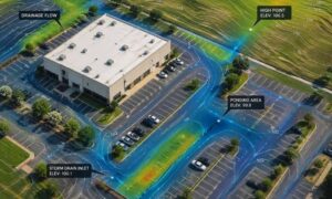
McKinney has areas that are prone to flooding. LiDAR detects low spots and slight elevation changes, which is key to designing proper drainage systems and avoiding future water damage.
Utility Mapping and Roadway Design
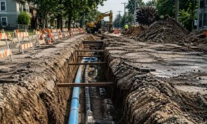
LiDAR helps map out the location of underground utilities and design roads that follow the natural shape of the land. This improves safety and reduces excavation errors.
How LiDAR Supports Other Survey Types
ALTA/NSPS Surveys
For commercial property transactions, ALTA surveys are often required by lenders. When combined with LiDAR, these surveys offer more detailed, accurate results.
Boundary Surveys
While LiDAR doesn’t replace the legal documentation of boundary lines, it adds another layer of data that can help clarify property edges and resolve disputes.
Construction Staking
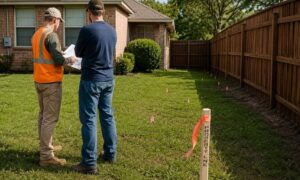
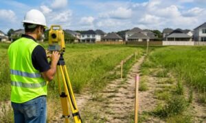
After designs are finalized, staking shows crews exactly where to build. LiDAR enhances this process by using digital models to ensure accuracy on the ground.
FAQs
Is LiDAR suitable for small properties?
Yes. Even if you have a small residential lot, LiDAR can give you valuable topographic insights, especially if your land has slopes, trees, or water features.
How long does a LiDAR survey take?
Most surveys take a day or less, depending on the size of the property. After scanning, we typically deliver the final data within a few days.
Can I combine LiDAR with other surveys?
Absolutely! LiDAR works great alongside:
- ALTA/NSPS surveys
- Boundary surveys
- Construction staking
What does a LiDAR map include?
You’ll receive:
- Detailed elevation data
- Contour lines
- Surface features like trees and buildings
- Digital terrain models (DTMs)
How accurate is LiDAR mapping?
Modern LiDAR systems offer accuracy within 2–10 centimeters, which is perfect for most land development and engineering uses.
LiDAR mapping is changing the way McKinney builds. With better data, faster results, and improved accuracy, this technology helps you make confident decisions—whether you’re planning a subdivision or just need to check your land’s elevation.