When people in North Texas hear that H-E-B is finally coming to town, excitement spreads quickly. But in Sherman, this new retail megasite is more than a shopping milestone—it’s a major civil engineering project. In late September, the city council approved a $12 million plan to improve roads, utilities, and drainage around the Crossroads area before construction begins. Behind the headlines about roadwork and new stores lies a challenge that will test every engineer’s skill in stormwater design.
Sherman’s Rapid Growth Brings New Pressures
That same week, Texas Instruments (TI) made headlines too. The company announced that it would scale back some of its older facilities in Sherman and Dallas while continuing to expand new 300-millimeter wafer plants. Together, these two stories show how fast Sherman is changing. The city’s mix of industrial and retail growth is putting more pressure on drainage systems that protect homes and roads when storms hit.
Sherman’s soil is mostly clay, which doesn’t absorb water well. Its rolling landscape adds to the challenge by sending runoff downhill fast. As more open land turns into buildings, parking lots, and pavement, stormwater flows faster and in larger volumes. That’s why smart stormwater design is now one of top priorities.
What the City Approved
The city council’s vote launched a public-private partnership to handle major improvements at Sherman Crossroads, near FM 1417 and U.S. 75. The plan includes several large projects:
- Relocating an existing lake to make space for H-E-B while keeping the same flood protection.
- Building a new collector road and traffic signal to handle the expected increase in vehicles.
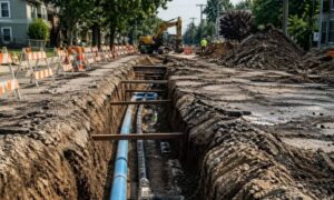
- Installing underground stormwater pipes, detention ponds, and utility lines for future development.
- Extending water and sewer service to serve surrounding properties.
Funding will come from a Tax Increment Reinvestment Zone (TIRZ). This setup allows future property taxes from new development to cover today’s infrastructure costs. It’s a smart way to grow without raising taxes for residents, while encouraging the kind of careful development planning surveys that make large civil projects like this possible.
The Stormwater Design Challenge
Relocating a lake might sound simple, but it’s one of the hardest engineering parts of the project. Civil engineers must calculate how much water the old lake could hold and design a replacement that stores just as much—or more. The new basin has to safely handle runoff during both 25-year and 100-year storm events. That means hours of modeling and simulation to get it right.
Sherman’s stormwater design manual, updated in 2024, makes this work even more demanding. Engineers now use more accurate rainfall data, draw precise drainage boundaries, and prove that downstream systems can handle extra flow. These steps keep nearby neighborhoods safe from flooding.
Coordination adds another challenge. Some new storm drains will tie into TxDOT’s right-of-way along FM 1417. Every pipe, slope, and outfall must meet state standards. Even a small design mismatch can delay approvals—and in a high-profile project like this, every day counts.
Balancing Flow and Function

As Sherman grows, more paved areas mean more runoff. Detention ponds help balance that flow. They act like holding tanks, storing water temporarily during storms and releasing it slowly to prevent flooding.
At the H-E-B site, engineers are planning several detention ponds to manage water from both public roads and private lots. These ponds must stay in perfect balance. If one drains faster than another, water could back up and flood nearby areas. Keeping everything synchronized takes constant communication between the city, engineers, and contractors.
Stormwater design isn’t only about controlling water—it’s also about protecting quality. New state rules require features like sediment traps, grassy swales, and oil-water separators to filter out dirt and chemicals before water reaches local creeks. These “green” systems make the design more complex but much more sustainable.
The Texas Instruments Connection
The H-E-B project isn’t happening alone. Just a few miles away, Texas Instruments continues expanding its advanced chip-making facilities. Even as older plants shut down, new utility corridors, roads, and drainage networks are taking shape to support future operations.
For civil engineering firms, this creates a mix of public and private work. Public projects like H-E-B must follow city timelines and detailed reviews. Private industrial sites move faster but require extreme precision and coordination. Managing both at once takes strong project management and teamwork between developers and local officials.
What Developers and Builders Should Know
For developers near crossroads, planning early is key. Starting hydrology modeling before grading begins can save weeks later. Early data helps size detention ponds, pipes, and drainage basins correctly the first time.
Contractors must also stay on top of TxDOT driveway permits and storm-drain tie-ins. These require separate state approvals, and missing paperwork can delay an entire job. Property owners near the H-E-B site should expect higher drainage standards as the area grows. Partnering early with a licensed civil engineer ensures designs meet all requirements before submission.
Stormwater Design as Smart Growth Insurance
Sherman’s growth is exciting, but it comes with responsibility. Every new building changes how water moves across the ground. Without good design, those changes can lead to flooding, erosion, or property damage.
That’s why stormwater design is more than a checklist—it’s growth insurance. It protects property, supports safety, and helps the city grow responsibly. Engineers now take a whole-system approach, combining roadway drainage, detention ponds, and water-quality systems into one plan. This approach reduces costs, shortens review times, and keeps the community ready for the next heavy storm.
Final Thoughts
H-E-B’s arrival is great news for shoppers, but the real story lies underground. The pipes, ponds, and channels built today will protect for decades. They show how careful planning and smart design can turn a high-profile retail project into a model for sustainable growth.
Through teamwork, innovation, and solid stormwater design, civil engineers are shaping a city built for the future. The excitement may start at the store opening, but the real success story flows beneath our feet.