Weather can turn a normal street into a problem zone fast. One hard freeze, one heavy downpour, or one sudden storm can shut down roads, flood intersections, and create dangerous driving conditions. Many people blame drivers or maintenance crews first. However, the real cause often starts much earlier — in the design itself. That’s where urban engineering makes a big difference.
Urban engineering focuses on how streets, drainage, and city systems work together. When engineers plan and design with weather in mind, streets stay safer and more reliable.
Why Some Street Networks Struggle in Bad Weather
Not all streets react the same way to rain, ice, or heat. You might notice that one road always floods while another nearby stays clear. There’s a reason for that. Design choices shape how a street performs under stress.
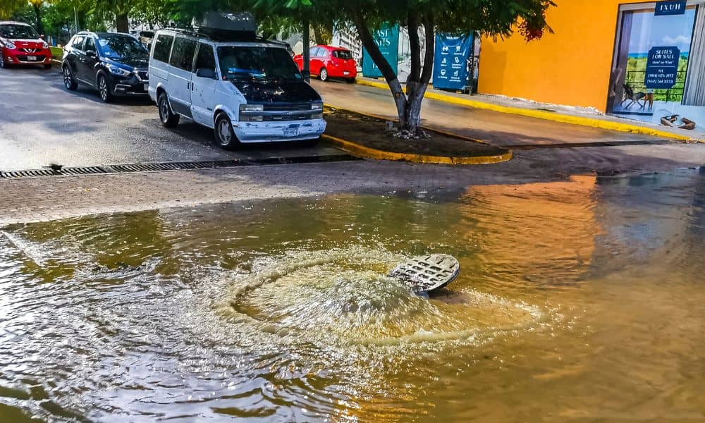
For example, low spots in the road collect water quickly. If inlets sit too far apart, water has nowhere to go. As a result, even a short storm can create deep ponding. In cold weather, that same water turns into ice.
Shaded streets also create problems. When trees and buildings block sunlight, ice melts slower. Bridges and overpasses freeze faster too because air moves above and below them. Meanwhile, worn pavement loses grip during wet weather, which raises accident risk.
Urban engineering looks at these details early. Instead of reacting after failures happen, engineers design streets to handle weather from day one.
What Public Complaints Often Reveal
If you read local forums or community threads, you’ll see repeating patterns. People say things like:
- “This intersection always floods.”
- “That bridge turns into ice first.”
- “Water runs straight across this road every storm.”
These complaints point to engineering gaps, not random bad luck. In many cases, runoff flows across pavement because designers didn’t map flow paths correctly. Sometimes, crews placed drains in the wrong spots. Other times, nearby development changed how water moves.
So, public frustration actually gives useful clues. Urban engineering teams can turn those patterns into data. Then they can design targeted fixes instead of guessing.
How Urban Engineering Maps Weather Risk
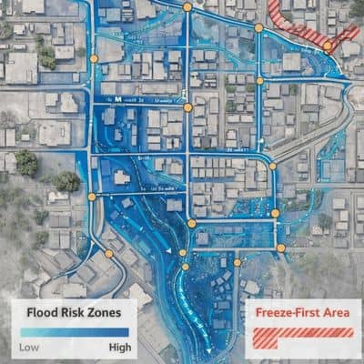
Strong urban engineering starts with mapping and measurement. Engineers study how water and temperature affect each part of the street network.
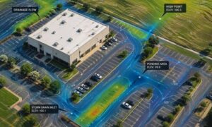
First, they review micro-topography. That means they measure small elevation changes across the road surface. Even a slight dip can trap water. Next, they model storm runoff paths. This step shows where water travels during heavy rain.
Engineers also identify freeze-first zones. These include bridges, shaded curves, and open wind corridors. In addition, they check drainage capacity against current rainfall data, not outdated charts.
Because of this mapping, cities can rank which street segments face the highest weather risk. That ranking helps leaders spend money where it matters most.
Surface Design Fixes That Improve Street Safety
Many weather problems start at the surface layer. Fortunately, urban engineering offers several direct fixes.
For instance, engineers can adjust the cross-slope of a road. That slope helps water move toward drains instead of sitting on pavement. Crews can also remove unintended sag points during resurfacing.
High-friction surface treatments help as well. These special coatings increase tire grip in wet or icy conditions. Cities often apply them on curves, ramps, and steep approaches.
In some cases, targeted resurfacing works better than a full rebuild. Engineers test friction and texture first. Then they treat only the risky zones. That approach saves money and delivers faster results.
Drainage Upgrades That Deliver Big Returns
Drainage plays a huge role in weather performance. Yet many street systems rely on old layouts that no longer match today’s storm patterns.
Urban engineering teams often start with inlet spacing. If drains sit too far apart, water spreads across lanes. Adding new inlets at capture points quickly reduces ponding.
Engineers also upgrade curb openings and channel paths. Better entry points move water off the road faster. In addition, crews can retrofit older inlets with higher-capacity designs.
Another smart move involves overflow planning. When a storm exceeds pipe capacity, overflow routes should guide water away from traffic lanes. Good urban engineering plans for that backup path instead of ignoring it.
Cold Weather Street Strategies
Cold weather brings a different set of challenges. Ice forms based on exposure, airflow, and moisture — not just temperature.
Urban engineering supports cold weather operations in several ways. First, engineers help cities map priority treatment routes. These routes include emergency corridors, hills, and bridge clusters.
Next, designers support anti-icing staging areas. Crews need fast access to salt and treatment tools. Smart placement cuts response time.
Engineers also reduce water sources near freeze zones. Better drainage near bridge approaches lowers ice formation. Even small grading fixes can help.
As a result, winter response becomes faster and more effective.
Why Small Fixes Often Beat Big Projects
Many people assume only large projects can improve street performance. However, urban engineering often proves the opposite.
Small, targeted fixes often deliver strong results. Adding two inlets at a flood spot may solve a years-long complaint. Correcting a road crown during resurfacing can stop cross-lane flow. Applying friction treatment on one curve can cut crash risk.
These micro-interventions cost less and move faster through approval. Therefore, cities can improve safety without waiting for major capital programs.
Smart engineering focuses on impact, not size.
What Developers and Property Owners Should Know
Street performance doesn’t depend on city roads alone. Nearby development affects runoff and drainage too.
When a new site adds pavement, water leaves the property faster. That runoff can overload nearby streets. Good urban engineering reviews downstream impact during site design.
Developers should test how their grading plans affect adjacent roads. They should also confirm that detention and drainage controls match real storm data.
Early coordination prevents future complaints and liability issues.
When to Bring in an Urban Engineering Team
Some warning signs show when expert help makes sense:
- Repeated flooding at the same street segment
- Ice problems at specific bridges or curves
- Weather-related crash clusters
- Drainage review flags during permitting
- New development changing runoff patterns
Urban engineering teams can model, map, and recommend fixes before problems grow.
Better Street Performance Starts with Better Urban Engineering
Weather will always test street networks. However, failure doesn’t have to follow. Design choices, drainage planning, and surface strategy shape how roads perform under stress.
Urban engineering turns scattered complaints into measurable solutions. With the right analysis and targeted upgrades, streets stay safer, drier, and more reliable.
In the end, resilient streets don’t happen by chance. They happen by design.