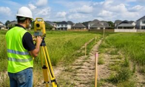
If you live in Austin, you’ve probably heard the big news: the I-35 Capital Express Central project is officially reshaping traffic, trails, and daily routines. The beloved Butler Hike-and-Bike Trail, which thousands of Austinites use every week, has been rerouted for years to make way for highway construction. For joggers and cyclists, it’s a major inconvenience. For surveyors and contractors, it’s a full-blown challenge. Every construction survey in this area now has to account for detours, staging limits, and shifting schedules that impact how projects move forward.
This is more than a traffic headache—it’s a test of how well crews can adapt to Austin’s largest highway rebuild in decades.
The Detour That Changes Everything
Starting September 15, the Butler Trail will detour around the I-35 work zone. A temporary 14-foot-wide trail is scheduled to open in October, but even with that fix, closures are still expected. In fact, Lady Bird Lake and nearby trail sections may shut down for three to seven days at a time, up to three times per year. For anyone trying to schedule fieldwork, that’s a moving target.
Surveyors rely on access—clear paths to set up tripods, drones, and control points. With fencing, parking lot closures, and limited staging near the bridges, simply getting equipment in place becomes a puzzle. These delays may feel small to the public, but for survey teams trying to hit deadlines, every lost day matters. And with every shift, a construction survey becomes harder to complete on time.
Field Access and Safety Come First
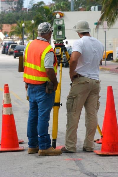
One of the biggest challenges is safe access. Parking under I-35, once a handy staging spot, is now off-limits. Emergency boat ramps around Lady Bird Lake are also restricted. That means hydrographic survey crews can’t just launch where they used to. Instead, they need to haul equipment further, coordinate with city agencies, and sometimes reschedule work entirely.
Safety fencing adds another layer. What looks like a short detour on a map can mean lugging heavy instruments around barriers, which slows down setup and raises labor costs. For drone crews, safety is just as critical. Launch points must be adjusted to avoid flight over active construction or closed public areas.
Surveyors don’t just measure land—they manage risk. In this case, the risk isn’t just to workers but also to the public moving through a very busy corridor. A construction survey must now double as a safety plan, not just a mapping exercise.
Working Around Tight Windows
Closures along the trail and lake will come in bursts—short, intense shutdowns rather than one long closure. For surveyors, that creates a scheduling puzzle. Topographic surveys, utility locates, and hydro work all need specific site access. If a three-day lake closure overlaps with a survey crew’s planned mobilization, weeks of planning can unravel.
This is where flexibility becomes the name of the game. Survey teams are now building wider buffers into their timelines. They’re also monitoring updates from TxDOT, the City of Austin, and The Trail Conservancy almost daily. Staying ahead of closure announcements means fewer last-minute cancellations and more predictable delivery for clients. For any construction surveys, timing is everything.
Permits and Coordination
In Austin, surveys near highways and waterways often require multiple layers of approval. The I-35 expansion makes this even more complex. Right-of-way permissions, traffic control coordination, and marine safety permits are all part of the equation.
Without these approvals, work can stall before it even begins. That’s why successful survey teams aren’t just technicians—they’re communicators. They work with project managers, city staff, and contractors to secure the green light well before anyone steps onto the site. The expansion project is forcing even tighter coordination, and surveyors who plan early are the ones avoiding costly standstills.
What Construction Surveys Deliver Now
So, what does a construction survey provide in the middle of all this chaos? More than just points and lines.
Surveyors are producing updated base maps that include temporary detour alignments. They’re marking staging yards, highlighting closed zones, and creating safety overlays for contractors. Drone teams are delivering orthomosaic maps that show not only the terrain but also live detour paths.
In short, surveyors are acting as navigators. They’re showing contractors and developers how to move through a constantly shifting landscape without losing time or money.
Turning Challenges Into Opportunities
At first glance, these detours look like nothing but obstacles. But in many ways, they highlight the true value of survey work. Anyone can draw lines on paper. It takes a skilled surveyor to anticipate real-world barriers—like a fenced-off staging area or a three-day lake closure—and build them into a usable plan.
For clients, this means one thing: order surveys early. The more lead time you give your surveyor, the better they can slot fieldwork around closures and coordinate with the right agencies. Choosing the right land surveying services isn’t just about maps and measurements—it’s about having a team that can adapt quickly when projects change. The I-35 expansion is a reminder that every construction survey comes with hidden challenges, and only proactive planning prevents surprises.
Final Thoughts
The I-35 expansion and Butler Trail detour are changing how moves, works, and recreates. For construction survey teams, the impact is immediate and ongoing. Access is limited, safety is tighter, and schedules are in constant flux. Yet with preparation, coordination, and flexibility, surveyors are proving they can adapt to one of the city’s biggest projects in decades.
If you’re planning work anywhere, don’t wait. Partner with a licensed surveyor who knows the challenges of this project firsthand. With the right team, what looks like a roadblock can become just another step toward completion.